Grand Teton National Park EIS.......
July 29, 2005
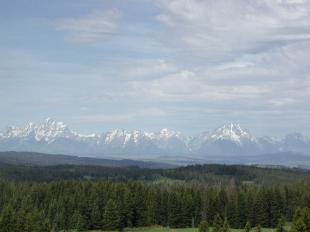 | |
A view of the majestic Tetons from Togwotee Pass, east of the Park. | |
If the EIS is adopted and the plan is approved, this will be the first time the National Park Service has undertaken development of a bicycling system with new trails and bike lanes. Other parks (Acadia, for example) have encouraged bicycling on existing rural roadways or carriage lanes.
The transit pilot envisioned in the plan is scaled back from earlier versions of the plan, but would enable the Park to begin working with local governments in Jackson Hole on a transit connection between Jackson and busy areas of the Park, and between Teton Village and the Moose Visitor Center. For more information about the EIS and the Parks review process, follow the link provided below.
Charlier Associates undertook the original Grand Teton National Park Transportation Study, completed in 2001, and prepared early versions of the final transportation plan, which was then revised and completed by NPS consultants.
Charlier Associates undertook the original Grand Teton National Park Transportation Study, completed in 2001, and prepared early versions of the final transportation plan, which was then revised and completed by NPS consultants.
To learn more about this project click here
Grand Teton National Park Service Plans

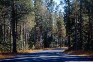 |
| Moose-Wilson Road is a narrow, low-speed rural lane that runs through a quiet corner of the Park, but is under increasing pressure from shortcutting to the airport and from commuters coming into and through the Park from Teton Pass. |
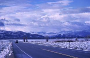 |
| The outer highway runs through the Park but is a regional highway connecting Jackson Hole with Yellowstone National Park, southern Montana and eastern Idaho. |